

We often have clear ideas about our needs as Tourists and curiosity about certain aspects or topics of a Territory we want to visit. Certainly, between what we desire as consumers and what we can find on the Market there is always a strong difference .
Precisely in order to meet certain Market demands in Tourism, which are defined as niche only because they are outside the usual types of products presented, Territorial Knowledge can be a valuable tool.
But what do we mean by Knowledge of the Land?
Our approach as A.I.LoveTourism is scientific. Our package creation system refers to a proprietary technology : Environmental Data Mining . The Knowledge of the Territory passes through the acquisition of Data; their Processing and Correlation and the concentration of this process in the real Knowledge, precisely.
The World does not change, its History, yes
A new world has taken shape from the spread of technological innovations applied to information and communication. Sociologists, economists, geographers observe and take note of this new reality trying to identify it with names and “labels”; thus we speak of Information society , of “information economy” ( Goddard, 1990), but also of “global village”, of “flow society”, that is, of network society . Communication and especially or information transmission channels become essential resources for maintaining and gaining competitive advantages, also because networks and nodes (real and virtual) are the essential basic structures, those that guarantee access, production and exchange of geographic information and represent the emerging aspect of it, real and proper containers where information is exchanged and produced.
Information has now assumed the status of a strategic resource, a resource that travels through specific and increasingly numerous channels of transmission to the extent of drawing a dense web of physical and intangible networks that have radically changed the traditional canons of spatial and temporal distance, accelerating the process of space-time convergence.
“Economics of Information “
Today, most of the physical circulation of the physical movement of goods is governed by information flows that activate information operations upstream and downstream of exchanges, originating a true information economy. Since the information revolution, entire economic sectors have been structured to sell information to businesses and households, and this is the most revealing innovation of our age. The inherent strengths of the information resource are numerous: ease of exchange and transmission, which makes information an extremely mobile factor ( time tending to zero) and relatively low cost; nochè easy reproducibility ( tending to infinity). For these reasons, technology applied to the handling of data and its processing is a fundamental tool for producing increasingly up-to-date and sophisticated infomrations and for offering services that are increasingly tailored to the needs of businesses and society as a whole.
In this context, the added value that arises from GIS (Digital Mapping Software) applications assumes more and more strategic value and becomes a fundamental atout for the development of the cycle based on data acquisition, management and processing; cycle based on data acquisition, management and processing; a cycle that allows raw data to be transformed into “informed” data, into resources to be enhanced and managed.
All the most important technlogical innovations that have had the effect of facilitating exchanges, contacts and transmission of knowledge among the world’s inhabitants have been inventions and innovations aimed at facilitating and speeding up the exchange of information (the invention of the printing press, the telegraph, radio and television, up to, the Internet). The current phase implies a new paradigm centered on iterative electronic communication, where socio-economic activities and functions are dematerialized and repositioned in an ever-changing virtual world. In the vast space of telematic flows, formed by a multiplicity of different actors, it is sites that realize an atomistically orgnized lattice structure where individual components interact continuously. It will be necessary to elaborate new conceptual categories capable of explaining the changes taking place related to the increasingly extensive and intense use of telematics, and to sharpen the theoretical weapons to study its effects on the organization of the territory.
The Invention of Virtual Space
In Virtual Space, where all physical barriers have been overcome, is the ultimate expression of relational space. The result is an environment where the fundamental dimensions of Space and Time lose their main characteristics: the “flat” Space, with no vertical relations enlivening it ( height and depth); and Time exists only in the Present, the moment measured by the networked passage of bits.
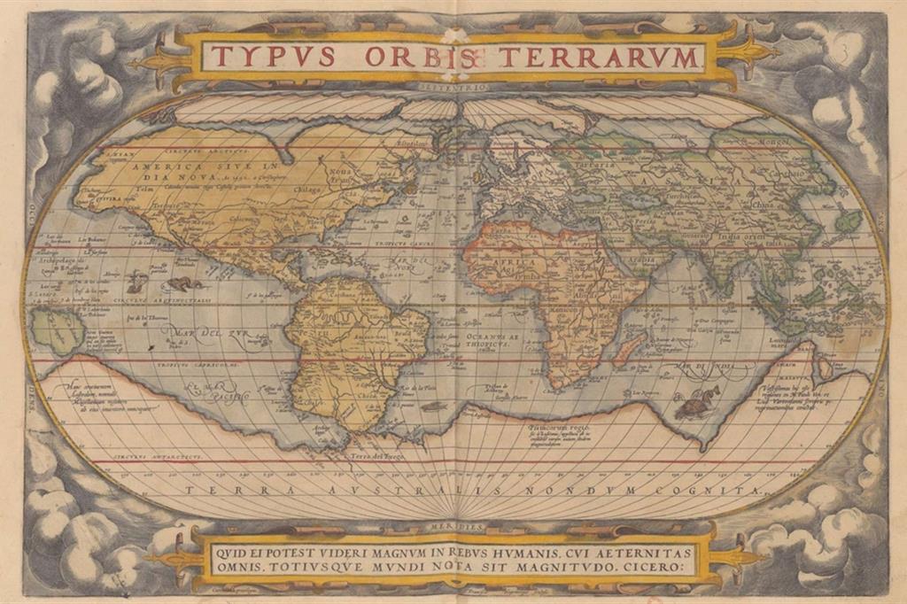
Data are simply a series of numbers if they are not sorted and processed according to logical criteria, that is, until they are transformed into information. It is important to talk about Geographic Information
Geographic Information ( or geodata) refers to information referring to phenomena that can be located in space and thus identified through geographic location at a point on the earth’s surface. Technological development and diffusion of innovations are based on a cumulative process of knowledge and knowledge, with each passage/exchange of information adds heat in quantitative terms.
In other words, data must undergo a production process aimed at processing , refining and selecting raw material, a process necessary to transform raw data into value-rich information; value obtained from the resources committed to the production process ( capital, knowledge and experience of operators, technologies). The development of strategies for organizing and regulating in each country the production of geographic information ( National Geographic Informazion Strategies ) must be planned and designed in a manner, coordinated to modernize governmental apparatuses and equip them with the necessary digital infrastructure , necessary to produce and manage Geographic Information .
This activity is related to GIS technologies in a direct way, both as a source of matarie first and, indirectly, as a development of the computerization process of public structures. The effects of this process are manifested with immediate feedback on the quality and production of data, since administrations are both producers and users of geographic information. In this regard, the E.U. ( General Directive No. XIII of 1998 ) has reiterated the urgency of having a European Geographic Infrastructure (EGI) based on common coordination strategies, also identifying the probable spin-offs in terms of economic and social benefits; benefits that may result from the greater territorial spread of these new geo-informatic technologies:
- Increased efficiency for the Unified World Market;
- Reduced problems for trans-European and pan-European projects;
- New opportunities for European industry related to geographic information;
- Ability to outline technical solutions for future growth;
- Increased use of specialized European expertise and improved position within the geographic information market;
- Improved decision-making and planning capacity.
Relationship between Data, Information and Knowledge
This relationship is circular, there is a continuous exchange between information flows, processing and informational feedback. At the lowest hierarchical level are the data, which are abundant, tend to be ubiquitous and have relatively low costs for acquisition, storage and transmission. At the second level, data have been processed, organized, integrated transformed into useful information for specific needs; these are further enriched by the necessary addition of the reference context generally referred to as “metadata.”
In other words, adding metadata to the data results in information . At the highest level is the knowledge that is generated from the previous operations, to which must be added the researcher’s experience in interpreting the information and spatial and temporal context .
The “metadata” is the data of the Data
The classic definition of metadata is “data about data”: metadata is a documentation of data primarily intended to provide useful information for a user to understand, compare, and exchange the content of the data described.
On the one hand, those who produce data have a clear idea of their resources and organize and manage them appropriately; on the other hand, the user of data is facilitated in discovering them, evaluating their usefulness for their purpose, and possibly purchasing them.
Metadata actually has two main functions:
- Provide a means of communicating that a certain database exists and how it can be accessed;
- Documenting the content, quality, and characteristics of a database to thus give full insight into its potential uses;
- Spread awareness of the information available;
- Increase the level of sharing among entities;
- Reduce the costs associated with duplication of acquisition processes;
- Make integration between distributed systems possible.
The starting point of spatial analysis concerns the selection of geographical objects to be examined; in parallel, information must also be added and selected in order to organize and process it according to logical-scientific criteria. The application of spatial analysis software brings to attention the need to rethink and redefine the role and spatial mechanisms of the dissemination and production of geographic information, at the local as well as at the global scale; redefinition that also invests the relatively less important fields of standardization rules and transmission criteria.
This article is intended, only, to report in a very mild manner what and how many technological possibilities can tell the story of a tourist area and, in the meantime, satisfy the demand of guests who are passionate about layered themes in the territories and who are not immediately advertised or preentatized in specific commercial packages.
HISTORY/TRAVEL – ALL THE SAINTS PLUS ONE – CLICK ON THE PHOTO BELOW


")

