
Intro
The drafting of the new Regional Territorial Landscape Plan (PPTR), initiated by the Region of Puglia ( Southern Italy ) at the end of 2007, which will replace the current Thematic Territorial Landscape Plan (PUTT/P), has included a specific activity aimed at giving systematicity to the knowledge of the regional cultural heritage through the cataloging and localization of cultural assets on the new Technical Map
The map was divided into three essential themes: Cultural Heritage, Landscape and Constraints. The subject of the census were all real estate and areas of cultural and landscape value located in suburban areas (particularly those indicated in Articles 136 and142 of the Cultural Heritage and Landscape Code).
The conceptual structure of the Charter
The body of data is based on the concepts of Topographic Unit, Site, Pluristratified Site.
The minimum element is the Topographical Unit (TU), i.e., the single cultural asset, which corresponds to or is included in a Site, understood from the perspective of landscape archaeology, as a place in which the presence of man has left traces, sometimes “invisible” (Manacorda 2007); an example of a Topographical Unit with respect to the Site as a whole may be one of the buildings that make up a farmhouse, one of the huts that form a village or one of the tombs of a necropolis. This hierarchical type of decomposition allows, on the one hand, a greater detail in the reading of settlements and, on the other, to avoid the risk of the multiplication of sites (also reported in Manacorda 2007, 12- 14) and resulting from the attribution of Site rank to any type of evidence. The Site, in turn, can be part of a Topographic Stratified Context (TCS), corresponding to the set of several sites characterized by coevolutionary relationships and connoted by a deep and perceptible integration with the surrounding landscape context; historic cities have been equated with TCSs arising from the sum of the “ancient city” and “modern city” SITEs
The physical model of the Charter
The information contained in the Heritage Map was integrated into the spatial database of the SIT, although the collection and cataloguing phase was carried out in offline mode, through a client-server type system. This phase made it possible to consolidate the data model, which, also in the perspective of use by the Regional Observatory for the Quality of Landscapes and Cultural Heritage, will be transferred to web technology using the basic services of the SIT, available today.
The data model is based on a classification based on the concepts of Type, Category and Function, allowing for the global filing of all types of data in a territory, overcoming the classic fragmentation into different sheets according to the categories of assets to be described. The Map is characterized by a high level of accuracy in the location and perimeter of assets (a fundamental element for protection and planning purposes) thanks to the possibility of using the Regional Technical Map at a scale of 1: 5,000 and the 2006 Orthophoto as a basis. A critical element in the creation of the Asset Map is the cadastral component, which is of particular importance in locating constraints. This was perhaps the need that most contributed to the conclusion of the agreement with the Agenzia del Territorio for the rasterization and georeferencing of the cadastral planting sheets and the unification of cadastral cartography to the WGS84 system, adopted by the regional SIT, through the identification of known points in the two reference systems.
Data: Bari and Brindisi ( Apulian cities )
The Working Group of the University of Bari in the first phase of the project proceeded to verify the data collected in the current Territorial Plan, as well as the censuses carried out, on the occasion of the first fulfillments and/or adaptations of the municipal General Regulatory Plans (PRG) to the PUTT, by the municipalities; this made it possible to clarify the nature of many Assets surveyed by the PUTT, often approximate and generic, as well as to specify their chronology, only sometimes reported and in any case indicated for long chronological arcs. Moreover, the comparison between the data collected by the PUTT and those deduced from the bibliographic research has shown that in many cases in the cited regional regulations Goods that are distinct from a functional and chronological point of view are united under a single denomination, i.e. without further indications useful for the precise location, while many Goods documented bibliographically even before 2002, the year in which the Plan was drafted, are absent.
The verification of the data collected in the regional regulations was flanked by the comprehensive and systematic perusal of the published documentation related to the territorial context. Against, in fact, 794 Assets identified by the PUTT for the province of Bari (excluding the municipalities currently part of BAT) and 341 Assets indicated for the province of Brindisi, the census carried out as part of the Cultural Assets Map allowed the identification of 2284 Assets and thus a difference of 1149 Assets.
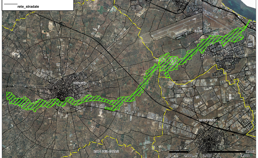
The turning point in the mindset of data cataloging and Lama Balice
In figura ( in alto ) Lama Balice – tra Bari e Bitonto
The scope of the work done so far emerges even more clearly if we consider the possibility of now considering the set of surveyed Assets not as individual buildings or as isolated evidences, but as an organic complex inserted in specific landscape and historical-cultural contexts and formed around precise aggregating elements of both environmental and geomorphological and infrastructural nature. The identification and perimeter of the CTSs thus allow for a diachronic and comprehensive reading of the settlement history of certain territorial contexts that, due to their geographical position, optimal natural resources, the presence of important infrastructures such as road axes and demographic poles of particular importance such as urban centers, are occupied, without solution of continuity, within a long chronological span. The examination conducted so far has allowed the identification of 12 CTSs in the province of Bari: an interesting example is certainly represented by the set of Assets gravitating around the Lama Balice catchment area ( Figure below ), which, from the Murge del Nord Barese – where it originates – to the coast near the Fesca district of Bari – where it ends -, crosses the municipal territories of Ruvo, Terlizzi, Bitonto, Modugno, Palo del Colle and Bari.
In fact, the erosive furrow of the Lama constituted an attractive element since prehistoric times, both because of the water supply possibilities it guaranteed and because of its conformation, which could be used as a natural way of crossing the territory from the hinterland to the coast. The persistence of settlement in the Roman and early medieval ages, documented by small inhabited nuclei locatable both along the main riverbed and along the beds of the ‘secondary’ blades, was further favored by the realization, in the 2nd century AD, of the Via Traiana, which reorganized pre-existing truncated roads and certainly constituted another important ‘aggregating’ element for this territorial compartment. The vitality of this territory still in the Middle Ages is well documented by the presence of a great number of rural churches, which are clustered precisely in the area surrounding the blade and, in particular, not far from the ancient Casale di Camarata, in the territory of Bitonto. The high number of rural houses of worship seems to confirm the widespread peopling of this territorial context still in the age .
Data: historic towns and rural architecture
The group of professors and researchers afferent to the Polytechnic University of Bari has been engaged in identifying and defining the limits of the ancient cities found throughout the territory of Apulia and their modern expansion. The historic city is understood as a complex urban organism, the result of a relationship between several aggregates pertaining to the same urban center, the product of its specific historical, typological and morphological process. The work program assumed as a priority the reorganization of the edited data processed within the departmental structures; subsequently, they were supplemented with monographic and in-depth studies. The criteria for drawing the perimeter of the “City” was based on the systematic comparison of the built-up part, present in the IGM Cartography at 25000 of 1949, and the built-up part, reported from the historical IGM Cartography of 1870 (available at a scale of 1:50000).
For the perimeter of the Modern City, that is, for the expansion parts, the systematic comparison was conducted between the built-up area present in the IGM Cartography at 25000 of 1949 and the Regional Technical Cartography. The Polytechnic was then called upon to systematize the perimeters concerning the Cultural Heritage of Apulia, which had already been surveyed by the working groups of other universities. The research involved, therefore, the reading of the entire Apulian countryside where the precise and recognizable forms of buildings and rural dwellings, the structure of roads, sheep-tracks and canals are evident; where the subdivision of the land, the arrangement of crops, the alignments, the tree-lined masses are clear elements that contribute to the formation and determination of the identity recognition of the landscape. The territory is understood, therefore, as a complex construction, defined over time, where nature and artifice enter into symbiosis, making the differences imperceptible. The theme of the Apulian rural house, referred to as masseria, rural building, rural house, tower, sheep masserie, and field masserie, was examined mainly in relation to the types of settlement and its relationship to the territory. The form of rural construction is not presented as a single organism, as a single completed artifact, but is defined through the superimposition, addition, and replacement of elements related to its productive evolution. A first reflection dealt with the relationship of the construction to the land, that is, its ability to organize and catalyze; the structuring of the land, its road and infrastructure networks were then examined. These reflections gave rise to the need to identify homogeneous areas, where the physical factor and historical events determine not only the perpetuation of land use techniques, but also the stagnation of settlement systems and the repetition of housing forms. Finally, about 1315 Architectural Assets including masserie, jazzi, villas, casini, farmhouses, towers, etc., were perimeter surveyed and listed, using the criterion of recognition through edited material and toponym research on IGM cartography at 1:25000 of 1949.
Now it’s up to Us … and earn from these jobs.
From what you have read above, you will have noticed how much information is available to us to create links between stories of the Territory and Tourism offered to our guests. Just with the little data introduced in this article, it would be possible to create three full days of thematic excursions on History, Nature and Rural Architecture . Days that will go a long way toward replenishing hotel sales and attendance.
Possibilities that until a few years ago were precluded to us, because software had a very high learning curve and data were available only in the form of unrelated and cataloged geographic coordinates with this attention.
The moral of the article is to take an interest in mapping technology to understand the richness of the stories encapsulated in the territory that can become the key element in distinguishing your hotel product from that of so many others; precisely because your position in the World offers unique products that cannot be reproduced by others.
All that remains is for us to familiarize ourselves with and understand the workings of programs, among others free of charge, such as QGIS or Google Maps itself, log on to http://www.sit.puglia.it/ and work with the plots and points offered by the catalogs on architectural and environmental heritage mentioned above.
Difficult work but could yield great results.
Or, log on to www.ailovetourism.com where we will be at your disposal for products tailored to your accommodation.
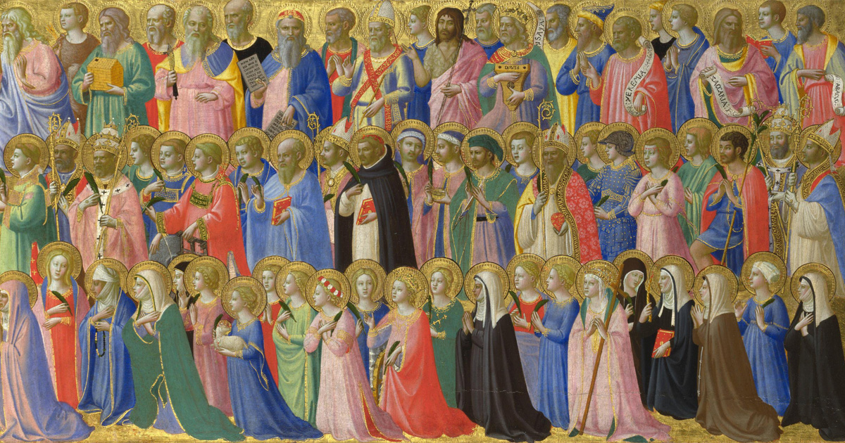
All Saints plus One
One of our Apulia travel packages to discover how the Deities of the 1300s are our recent Superheroes
Contact Us for Info
Address
via Ammiraglio Millo, 9
info@ailovetourism.com
Phone
+39 339 5856822


")


 – the Illustrious Past.")


")

