
Electronic Cartography and Digital Tourism
In a previous article on Cartography as Absolute Science we introduced the concept of information as a “weapon” to promote not only Territory but our hotel sales. With this article we will go a little further; introducing concepts of spatiality and knowledge that are not separable if we want to make ourselves commercially unique.
I will confide one thing to you: talking about the subject will require many articles because the power of these technological tools is continuously becoming, and as I am writing these lines, new software is being released.
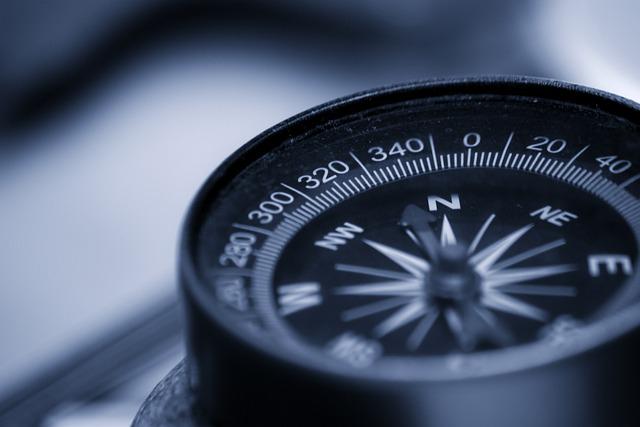
We introduce the notion of Digital Cartography, which an international acronym defines as : G.I.S.(Geographic Information system ).
Computer Cartography
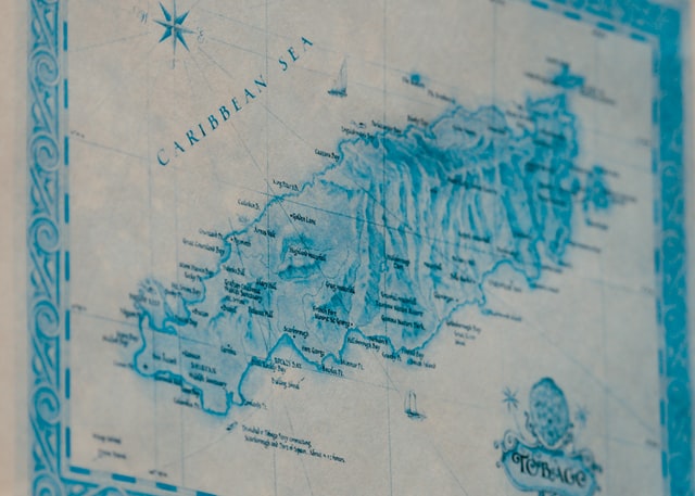
Maps are both the expression and the product of the socio-cultural environment from which they originate: in this sense, cartography made thanks to electronic processors also fits fully into the recent information technology revolution where everything passes through computerized technology and information circulates on a network. The signs and symbols, i.e., the codes of cartography, have been transformed into files and stored in the capacious memories of computers; with this technology the function of maps as a carrier and transmitter and communicator of information undergoes an impressive acceleration.
The first attempts at computerized cartography date back to the 1950s, and although it was precisely the dawn of this technique as well as the dawn of information technology, the foundations laid have proved to be solid, so solid to the point that cartographic software packages are currently widespread and used everywhere. Digital Cartography was born out of the application of computer technologies to traditional cartography, in fact the introduction of computers into the cartographic industry has profoundly transformed the entire production process, forcing the adoption of new criteria and new tools for drawing maps. Computerized Cartography offers numerous opportunities (greater flexibility, speed, accuracy) to improve the stages of the cartographic process. In summary, graphic representations are “translated , through appropriate algorithms, into numerical archives “in which the coordinates and all other elements that characterize the figures and the quality of the representation are encoded.” The position and description of the elements are stored in files, and the relationships between geographic elements are expressed through topology.
A SINGLE MAP PRODUCES TWO MORE, MINIMUM
Parallel to the development and dissemination of software program packages, the ability to produce maps of any type, at different spatial scales, easily updatable and, above all, inexpensive, has increased. The main applications of computerized cartography concern the production of general and thematic maps, image analysis, and, of course, G.I.S. The fields of application of numerical cartography are increasingly broad both in the public administration sector and for private enterprises. These are some examples of the type of services offered by companies 10 operating in the field of digital cartography:
- Vectorization (topographic and aerophotogrammetric maps, geological maps, cadastral maps, technological networks);
- Making thematic maps;
- georeferencing with gps instrumentation (Global Positioning System).
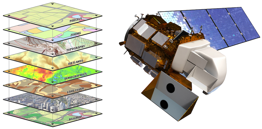
The possibilities offered by the technique of photogrammetry, first introduced for military purposes during World War I, opened up new scenarios for Cartography; but the real turning point in cartographic research came with the launch of satellites into space. Remote sensing was born in the i960s and can be defined as the set of techniques and instruments that enable the collection and interpretation of information about objects placed at a distance on the Earth’s surface. According to the greater or lesser distance between the detector (and/or I instrument) and the phenomenon to be detected, three types are identified: sensing from the ground (proximal sensing) from aircraft and from a satellite. Today, satellite imagery has assumed “a prominent role not only in geography, but also in meteorology, geology, and zoology.” The wide range of applications (monitoring, cartography, modeling), together with the vast amount of information that can be found (from the physical environment to anthropogenic land-use transformations) and the extreme precision achieved by the information, makes these techniques powerful tools at our disposal for spatial analysis and motivates their rapid dissemination.
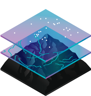
Digital Cartography, in addition to having all the advantages associated with the use of information technologies (excellent graphic resolution, speed of execution, possibility of entering and updating information, etc.), also lends itself excellently to being integrated with gis. The result of this fusion of different technologies is to offer a tool that is both flexible and capable of producing cartographic synthesis and spatial analysis. In this sense, the introduction of Geographic Information Systems (sig in Italian/international gis) can be likened to a true radical innovation, a new and powerful technology at the service of spatial knowledge and its representation. In the technological age, increasingly dominated by telematic processes, the adoption and use of gis technology can open up new fields and new ways of spatial investigation by stimulating a virtuous circuit involving the supply and demand for geographic data. Cartographers have always been sensitive to innovations involving map-making techniques, and today, thanks to the contribution of new information technologies, this innovative process opens up new scenarios and throws up new challenges. The main differences between traditional cartography and gis mainly concern the stages of data processing and the final stage of actual cartographic production, that is, two essential stages of the entire cartographic process. The added value of gis can be identified in the fact that each stage of processing and representation can always be used as a starting point for building a new database; in other words, the end point can always also be a new starting point for further processing. If, in traditional cartography, points, lines and areas are represented with symbols and printed in a linear (input/output) process, with gis the concept of circularity is introduced, i.e., points, lines and areas are organized in a digital database, which can be implemented, modified and updated. In addition, gis technology makes it possible to integrate digital spatial information with a variety of different sources chosen and selected not so much by software producers as by the consumers themselves, concretizing the possibility of “tailoring,” according to specific needs, the software and tools used
…THERE IS DATA AND DATA
From what you have read above, you can well understand how this type of Technology is cross-cutting with Territory marketing that uses only "commercial" data. Let me explain further. What reason would I have to use a G.I.S. are to show, for example, only the average age with the location of my customer history?
The answer, in fact, is, you could, but that would be reductive. You can, instead, use commercial data and figure out what historical, social, political, naturalistic phenomena might have occurred over the centuries and see them represented in a G.I.S. and eventually use the commercial data to present this unique information to your customers who like these kinds of topics.
Obviously, the weapons at your disposal, once you have certain data, will be dictated by your imagination and the type of unique information present in the Territory where your accommodation resides .
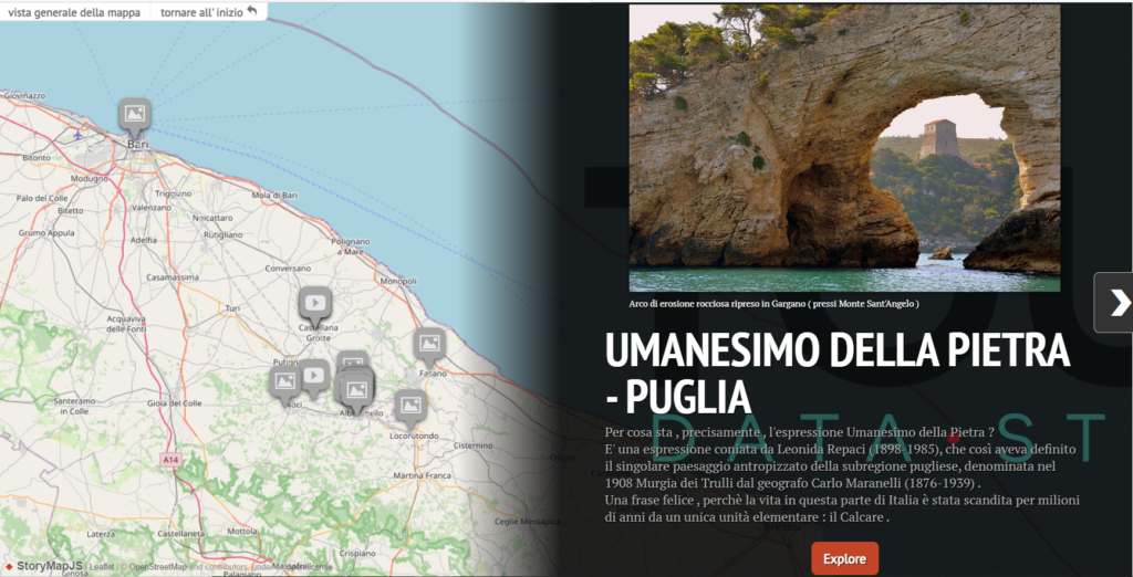
IF YOU ARE INTERESTED IN A JOURNEY THROUGH THE UNKNOWN TRADITIONS OF PUGLIA :
We are organizing a small group for a Journey/Story to incredible places and stories related to the theme Dry Architecture in Apulia . A journey produced with our technology;Environmental Data Mining


: when the Fiat Campagnola was unveiled at the Fiera del Levante.")


")

