

Hyper-accurate positioning is spreading around the world
Upgrades to orbiting satellites and dedicated systems will bring centimeter-level accuracy to the masses.
News story. A huge landslide-the worst in decades-hit the home of Du Fangming, in the southern Chinese province of Hunan, on July 6. “My house collapsed. My goats were swept away by the mud,” he told Chinese media shortly after the disaster. Fortunately, however, he was safe, one of 33 villagers who had been evacuated thanks to early warnings enabled by advanced positioning technologies that can provide more accurate readings than ever before.
Using China’s newly completed BeiDou (“the Great Bear”) global navigation satellite system and its ground stations, position sensors can detect subtle changes in the ground surface in landslide-prone regions throughout China. Movements of a few meters can be detected in real time, while post-processing accuracy can reach the millimeter level.
This means that a shift in the earth the size of the tip of a sharp pencil can be detected from more than 21,000 kilometers above sea level. Twelve days before the landslide, the village of Du had received an orange alert for anomalies in the data, which indicated accelerated surface sliding following days of heavy rains.
Twelve days before the landslide, the village of Du had received an orange alert citing anomalies in the data, which indicated accelerated surface sliding following days of heavy rains.
Du village is among more than 100 sites in Hunan equipped with monitoring and early warning systems. “This service would not have been possible if the accuracy of satellite positioning was still at the meter or decimeter level,” says Yuan Hong of the Aerospace Information Research Institute of the Chinese Academy of Sciences in Beijing, where he has worked on BeiDou for decades.
Today, more than ever, we rely on technologies that can determine our location or pinpoint the position of an object. Precision agriculture, drone deliveries, logistics, ride-hailing ( rendering first aid using medical drones ) and air travel all depend on highly accurate position sensing from space. Now a series of installations and upgrades are increasing the accuracy of the world’s most powerful global positioning satellite systems from a few meters to a few centimeters.
This could mean that your phone not only knows which street you are walking or biking on, but also which side of the road you are on. Someday, this kind of resolution could make it possible for self-driving cars or delivery robots to safely navigate roads and sidewalks.

GPS gets better and better
Improves technology and with it statistical algorithms on software error evaluation
New and improved satellites
The Global Positioning System (GPS), one of the world’s first satellite systems, has changed the way billions of people get around. Since 1993, at least 24 GPS satellites have been orbiting the Earth and constantly transmitting their positions. Any GPS receiver can find its current position in seconds by triangulating signals from at least three satellites in the constellation.
Once signals are processed by a receiver, GPS is generally accurate to within five to ten meters. Now the system is in the midst of a years-long upgrade to GPS III, which is expected to improve its accuracy to one to three meters. Four of the 10 GPS III satellites were launched in November 2020, with the others expected to be put into orbit by 2023. Although consumers will not notice it right away, the accuracy of their navigation systems and smartphone location apps should improve accordingly.
In June 2020, China also completed the deployment of the BeiDou satellite constellation as an alternative to GPS. Expanded over two decades from a regional to a global network, BeiDou now has 44 satellites operating in three distinct orbits. It provides positioning services to anyone in the world with an average accuracy of 1.5 to 2 meters. However, because the service is historically focused on China and Asia, regional users of BeiDou can often get better location information, with accuracy close to one meter.

Il GPS migliora sempre di più
Aumentare la precisione a terra
Anche con questi progressi, i segnali di posizionamento
subiscono interferenze e altre condizioni che possono renderli errati.
La correzione di questi errori richiede un ulteriore livello di tecnologia.
Both BeiDou and GPS rely heavily on ground-based augmentation to increase positioning accuracy to the centimeter level. One popular approach is real-time kinematic positioning (RTK), which uses a base receiver and a rover receiver, placed miles apart, to receive satellite signals and calculate errors caused by the Earth’s ionosphere. This technique can achieve accuracies of less than three centimeters.
Similar but newer technology is precise point positioning (PPP). It requires only one receiver and works from anywhere on the earth’s surface, offering users decimeter to centimeter accuracy.
In China, RTK augmentation is relatively mature, and thousands of base stations have been built across the country, says Yuan: “We are now developing a technology called PPP-RTK to combine their strengths and [we hope] to be able to use it in a few years.”

Il GPS migliora sempre di più
Beyond satellite positioning
More precision, more tools including marketing
As the accuracy of satellite positioning improves, we will no doubt find even more ways to use it. Eventually, however, traditional satellite systems will reach a limit in accuracy, probably around the millimeter mark. So researchers are exploring new positioning technologies that could take us beyond that limit or at least reduce our dependence on satellites.
One approach uses the quantum properties of matter to locate and navigate without external references. When atoms are cooled to just above absolute zero, they reach a quantum state that is particularly sensitive to external forces. Therefore, if we know the initial position of an object and can measure changes in atoms (with the help of a laser beam), we can calculate the object’s movements and find its position in real-time.
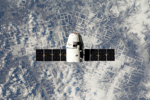
Quantum positioning would be particularly useful in situations where satellite systems such as GPS or BeiDou are unavailable, such as in deep space or underwater, or as a backup navigation technology for self-driving cars. A very early version of a quantum positioning system, developed by ColdQuanta in Boulder, Colorado, is currently in operation on the International Space Station.
What can all this change in the hotel and tourism world in general? Think of a vision of the Future where the location of objects and those who have to use them is accurate to the centimeter. The possibility, perhaps, of using drones that with very accurate georeferenced sensors and Augmented Reality or Virtual Reality technologies can visit places for us recreating them in real-time in the Metaverse . A true Immersive Tourism.
Or, the possibility of being able to manage in cities affected by Overtourism I could manage urban mobility in real-time , avoiding so many disruptions for both guests and citizens of that location.
Our ancestors looked to the stars and compasses to figure out where they were; today we use atomic clocks on orbiting satellites to do the same. New positioning technologies have already changed the way we farm, transport goods and navigate our world, and the latest improvements will bring it into even sharper focus. As positioning technology advances to the millimeter level and beyond, the limits of its use will be defined more by our creativity and the legal or ethical limits we set than by the performance of the technology itself.


")

